The thematic maps were prepared with ArcGIS from the coordinates entered into the information database. They show the sampling sites, the spatial distribution of arthropods, the pathogens detected and the resulting zoning of territories by degree of epizootological tension.
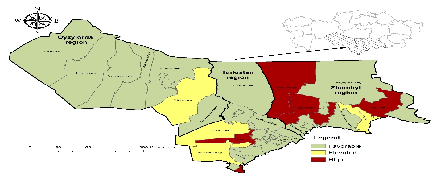
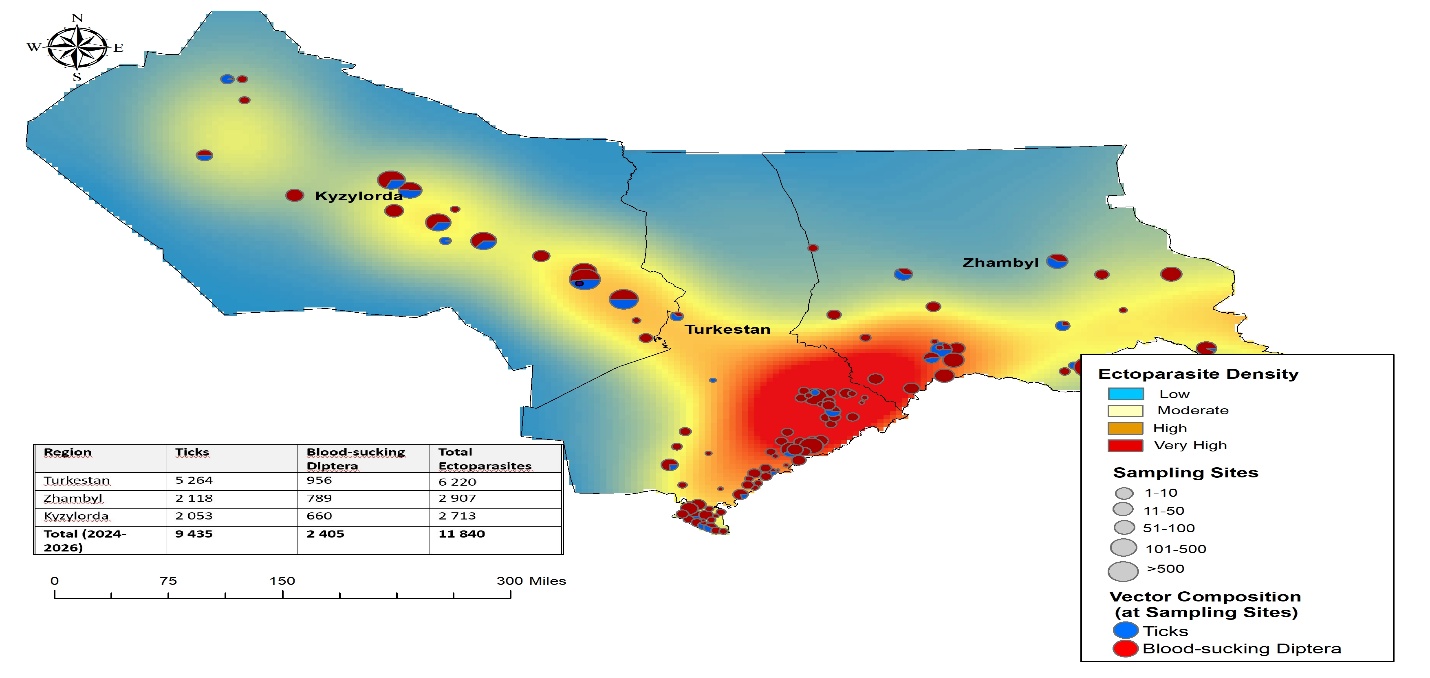
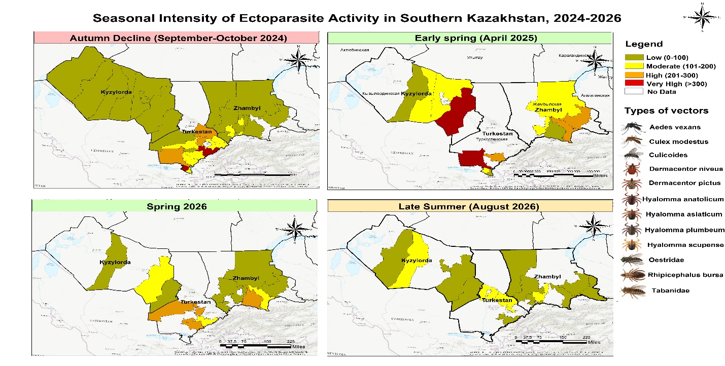
Zoning of Southern Kazakhstan by the level of epizootic situation intensity.The map shows the spatial zoning of Southern Kazakhstan according to the level of epizootic situation intensity. The territories are divided into three categories: favorable (Favorable), elevated (Elevated), and high (High). A favorable situation is observed across most of Kyzylorda Region, whereas areas with elevated and high intensity are mainly concentrated in certain districts of Turkistan and Zhambyl Regions. This distribution makes it possible to visually identify territories requiring enhanced epizootiological surveillance and priority monitoring.Spatial distribution and density of ectoparasites in Southern Kazakhstan.The map characterizes the spatial distribution and density of ectoparasites, as well as the location of sampling sites in Kyzylorda, Turkistan, and Zhambyl Regions. The color gradient reflects changes in density from low to very high. The highest concentration of ectoparasites is visualized in the southern part of the study area, predominantly in Turkistan Region, while density gradually decreases toward Kyzylorda Region. The size of the symbols represents the number of ectoparasites at sampling sites, while the color composition of the symbols reflects the ratio of ticks to blood-sucking dipterans. Thus, the map makes it possible to identify spatial zones with the greatest accumulation of ectoparasites and areas of increased activity.Seasonal intensity of ectoparasite activity in Southern Kazakhstan, 2024–2026.The map demonstrates the spatiotemporal dynamics of ectoparasite activity in Southern Kazakhstan during 2024–2026 and covers four seasonal periods. In autumn 2024, low activity was observed across most of the territory, while individual areas of high and very high activity persisted mainly in the south. In April 2025, pronounced spatial heterogeneity was observed, with the formation of areas of very high activity. In spring 2026, low and moderate activity levels predominated, with individual areas showing high activity. By late summer 2026, activity was predominantly at low and moderate levels. Overall, the map demonstrates pronounced seasonal and territorial variability in ectoparasite activity, making it possible to identify the periods and territories of greatest importance for epizootiological monitoring.